Stages in the Development of Turtle Mountain1. 30,000 BC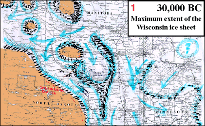 Maximum extent of the Wisconsin glacial period. The glacier, flowing generally from northeast to southwest, has penetrated the Missouri Plateau (brown) in places, leaving isolated limestone buttes. 2. 12,000-6,000 BC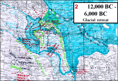 As the glacial front retreats towards the northeast, the troughs it gouged out fill with floodwater. A series of lake levels fill and empty in turn as the glacier and the floodwaters diminish. 3. 10,000 BC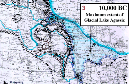 A snapshot of the land as it might have been about 10,000 BC when all of the Turtle Mountain region was free of ice and the Spirit Sands Delta had been formed. < Introduction | Contents | Petroform Astronomy > |
Copyright © 2002 Moncur Gallery. All Rights Reserved. Republished with permission.
This is document available from: http://turtlemountain.org/exhibits/mythandhistory/stages